

22
districts covered
8
key climate hazards
3
future periods, under two emissions scenarios (RCP4.5 and RCP8.5)
1
interactive Climate Map for the whole Nation
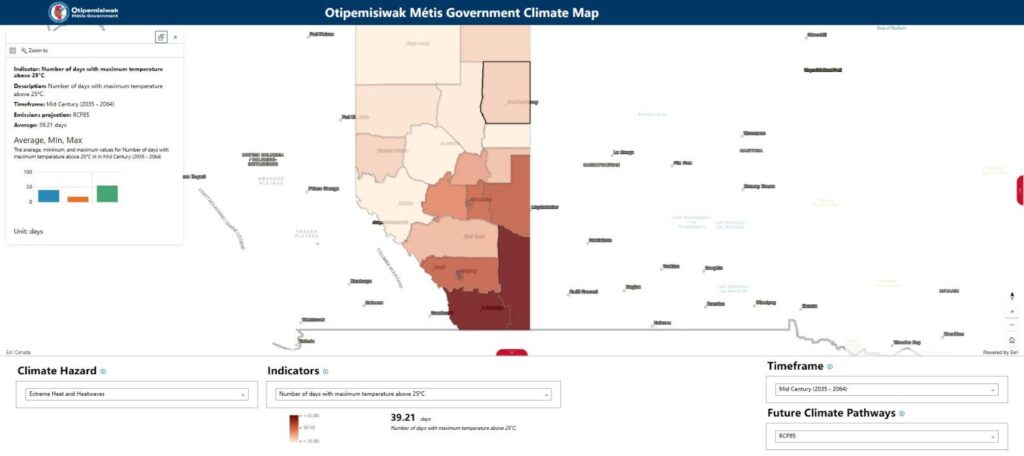
The MNA Climate Map is public: open the live map (opens in a new tab). Screenshot above shown with the permission of the Otipemisiwak Métis Government.
The question
The Otipemisiwak Métis Government needed to understand how the climate is projected to change over the 21st century across Alberta, and what that means for Métis communities, infrastructure, the economy and the natural environment in its 22 districts, so that policy decisions, governance strategies and long-term planning rest on evidence.
What we did
We developed high-resolution climate projections from the NA-CORDEX regional climate model ensemble, under two emissions scenarios (RCP4.5 and RCP8.5) and three future periods, and hazard analytics for eight climate hazards across Alberta’s six natural regions and the Nation’s 22 districts. These projections underpin the Nation’s Climate Risk and Vulnerability Assessment (CRVA), delivered with The Resilience Institute alongside Indigenous Knowledge, and we led the technical design of the MNA Climate Map.
- NA-CORDEX projections
- Indigenous Knowledge
- GIS decision support
What the MNA received
- Climate projections and hazard analytics for the Nation’s Climate Risk and Vulnerability Assessment, covering all 22 districts
- Hazard analytics for eight climate hazards across future scenarios
- The MNA Climate Map, an interactive GIS tool that shows climate and resource data for each district
- A communications video for community engagement
What changed
The assessment and the map support evidence-based adaptation planning, community engagement and long-term climate resilience across the 22 districts. The Climate Map gives citizens and administrators a single source of historical and future climate information for planning and carrying out climate-resilient initiatives, down to the community level.
The eight hazards assessed
- Avalanches and landslides
- Drought
- Extreme heat and heatwaves
- Heavy precipitation and flooding
- Permafrost thaw and glacial retreat
- Seasonal change and ecoregion shift
- Water security
- Wildland fire, smoke and air quality
Related service
LastMile brings your climate risk assessment to the people it affects, on a map they can explore.
Discuss your project
Start with a 30-minute call with a climate scientist about your question, your data and your timeline.