

Services
Climate adaptation and mitigation services
Weather and climate baselines, downscaled projections, design values for extremes, hydrological modelling and forecasting, risk and infrastructure assessments, emissions pathways and low carbon resilience. Each service follows recognized standards and draws on delivered projects and research.
Manage climate risk
Climate adaptation
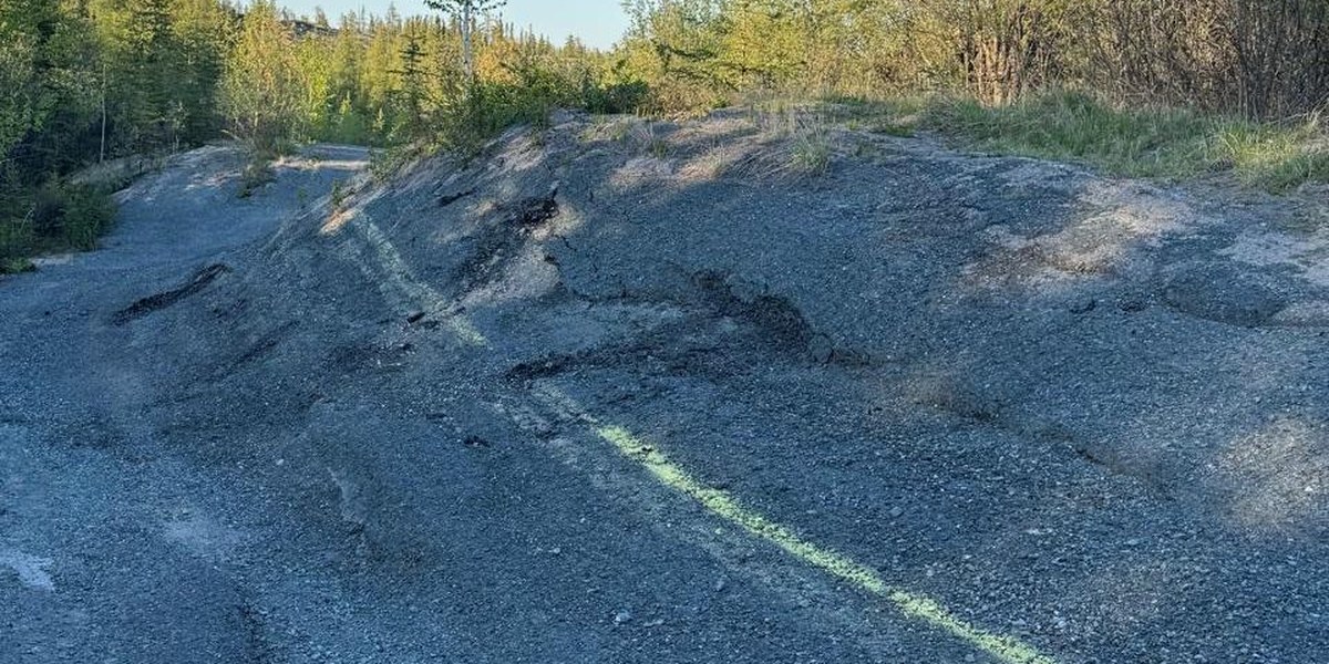
Climate data and projections, risk assessment and design values for extremes, from intense rainfall, floods and low flows to freezing rain, heat and drought.
What you receive
A scored risk register and adaptation priorities for a community, a government or an asset portfolio, with likelihood and consequence traceable to the data.
Standards
Such as ISO 31000, ISO 14091, PIEVC (including the Large Portfolio Assessment Manual), ICLEI BARC, CCME, First Nations Infrastructure Resilience Toolkit
Projects
Government of New Brunswick; Nunavut; Northwest Territories; Métis Nation of Alberta; Swampy Cree Tribal Council; City of Mississauga; Gov-CDR Philippines; St Kitts and Nevis (GCF); GIZ Iraq (GCF climate rationale); Peshawar, Pakistan
What you receive
Downscaled, bias-corrected projections and climate indices, with tables, hazard maps and confidence statements.
Methods
Such as CMIP6 SSPs, CORDEX, NEX-GDDP, CanRCM4, ERA5-Land; multivariate bias correction; WRF convection-permitting downscaling; IPCC AR6 Climatic Impact-Drivers
Projects
77 indices for all 82 Philippine provinces; Canadian Centre for Climate Services northern climate profiles; GIZ Iraq governorate profiles and GCF climate rationale; Metolong Dam, Lesotho; Water Security Agency gridded climate data
What you receive
Quality-controlled and gap-filled station records, site climate baselines, gridded data and reconstructions of past storms.
Methods
Such as station quality control and homogeneity checks; stochastic weather generators; ERA5-Land and other reanalyses; satellite precipitation evaluation
Experience
Lesotho station records for the Metolong Dam; Water Security Agency gridded data; open forcing datasets for North America and the Mackenzie River Basin
What you receive
IDF curves and design storms, probable maximum precipitation and floods, freezing rain, heat and drought indices, and design floods under climate change.
Methods
Such as GEV and non-stationary frequency analysis; PMP by statistical and storm-based methods; climate change allowances in flood estimation; design storms for future climate scenarios
Projects
Giant Mine extreme precipitation, IDF and PMP; EPRI Ontario freezing rain and drought
Hydrological modelling, forecasts and projections
Also: Hydro-meteorological forecasting · Surface water resources management · Integrated water resource management planning
What you receive
Streamflow, water yield and reservoir inflow projections under climate change, flow forecasts with their uncertainty, and forcing data for your own models.
Methods
Such as CRHM, Raven, MESH and WRF-Hydro; ensemble forecasting and data assimilation; Delft-FEWS; multivariate bias correction of forcing data
Experience
Mackenzie River Basin forcing data for MESH and CRHM; Saskatchewan flow forecasting and reservoir operations; climate inputs to the Barbados groundwater model
What you receive
Climate Lens and PIEVC assessments of single assets, with projections to the end of their design life.
Standards
Such as PIEVC, Climate Lens, Envision, ISO 31000
Projects
Giant Mine Climate Ready Mine Project; Ramadi drinking water treatment plant, Iraq (PIEVC Green); SaskWater regional landfills; Martensville Recreation Centre; Swift Current aquatic centre
What you receive
Guidelines, training, codebases and hubs that let your own staff produce and update the evidence.
Methods
Such as likelihood-scoring and data-scoping guidelines; train-the-trainer; Jupyter and cloud pipelines
Projects
Applied Climate Science for Infrastructure Practitioners course, since 2021; Gov-CDR upskilling, Manila; ONACC, Cameroon; Mali pilot; Nile Basin Initiative climate proofing hub; PIEVC pilots in Lesotho and Georgia
What you receive
Independent expert reports, reviews of other experts’ reports and testimony on weather, climate and water, such as rainfall, snow, freezing rain, wind, heatwaves, floods, drought and drainage.
Methods
Such as station and reanalysis records; extreme value and IDF analysis; hydrological and runoff modelling; downscaled projections
How we work
Prepared to the expert evidence rules of courts and tribunals; independent of the party that retains us; case details kept confidential
What you receive
A Climate Map built from your existing assessment: hazards, risks and actions by neighbourhood, for residents to explore. You host it under your name, and it is refreshed as the science changes.
Tools
The LastMile-ready schema; ArcGIS Online, ArcGIS Enterprise or QGIS
Projects
The MNA Climate Map: 8 hazards, 22 districts
Adaptation and mitigation together
Low carbon resilience
Adaptation and mitigation planned together, from the evidence to governance and implementation. Climalogik is Lead Technical Partner on the Low Carbon Resilience program, with REFOCUS Sustainability and ACT at Simon Fraser University.
What you receive
A cross-departmental team and governance, an updated risk assessment, emissions pathways, costed scenarios, an implementation plan, and monitoring and training.
Methods
Such as ISO 14091 with ICLEI BARC; CMIP6 SSP basis; comparative cost and trade-off analysis of pathways
Projects
City of London; Dufferin County (FCM-funded)
Cut emissions
Climate mitigation
Emissions inventories and reduction pathways, with the cost and trade-offs of each option.
What you receive
Corporate and community GHG inventories, reduction pathways to a target year, and the cost and trade-offs of each low carbon option.
Methods
Such as GHG Protocol and GPC inventory methods; scenario modelling; comparative cost and trade-off analysis
Projects
Climate Lens GHG mitigation assessments for SaskWater, Martensville and Swift Current; City of London and Dufferin County, through the Low Carbon Resilience program
Data and tools
Climate Intelligence: data, models and tools
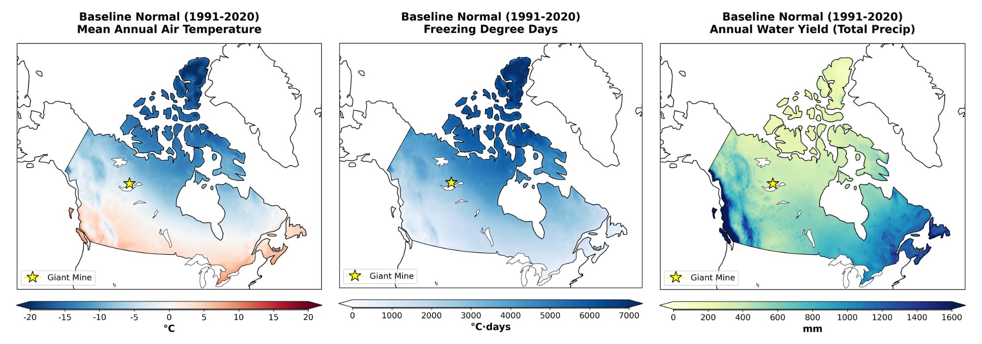
Climate data, pipelines and tools your team owns and can rerun.
What you receive
Observed and gridded climate records (ECCC stations, ERA5-Land), downscaled CMIP6 projections and indices, extremes (IDF, PMP, freezing rain), hazard and exposure layers, and emissions data, through reproducible pipelines, dashboards and the Climate Intelligence Engine.
Tools
Such as Google Cloud, Jupyter, GIS; open metadata standards (ISO 19115)
Projects
Philippine national climate pipeline; the Climate Intelligence Engine; the MNA Climate Map; R&D: open forcing datasets on FRDR
Discuss your project
Start with a 30-minute call with a climate scientist about your question, your data and your timeline.