

Climate adaptation
Climate data, downscaling and projections
Downscaled climate projections for a district, watershed or asset, delivered as climate indices that planners and engineers can use.
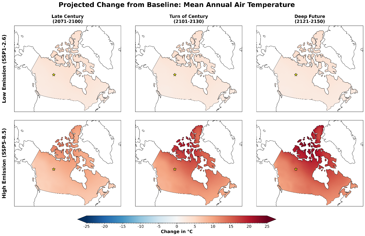
From global models to your site
Translating global- to local-scale climate scenarios for critical planning efforts and decision-making under uncertainty.
It is now unequivocal that human influence has warmed the climate, and the changes ahead present substantial uncertainty to society. Climate change shapes important decisions about the design, location, construction and operation of key cross-sectoral infrastructure and resource planning, and about ways to reduce their vulnerability and risks to extreme weather. These risks will continue to grow as the 21st century progresses. But how do project managers, professionals and communities plan for uncertain climate change magnitudes and timelines? This challenging question often leads to a “wait and see” holding pattern. However, postponing an honest assessment of climate change risks and assuming a “business-as-usual” approach to planning is a risky proposition. Practical climate change considerations can be factored into cross-sectoral decision-making now, even with uncertainty in the magnitude of future change.

As the climate changes, risks of infrastructure and ecosystem failure are likely to increase, particularly in northern regions, as weather patterns shift and extreme weather becomes more variable and regionally more intense. Communities’ ability to adapt requires specific information on how key variables such as temperature, precipitation and wind speed will change locally, how these changes may vary through the seasons, and how new climate extremes will interact with key assets. Such projections are generally based on global climate model (GCM) simulations at a coarse scale, typically about 100 to 300 km. Site-specific projects need finer-scale climate data to understand climate change impacts, so for practical applications these projections must be downscaled (and bias-corrected) to the local scale, either statistically or dynamically, for example with the Weather Research and Forecasting (WRF) model. Statistically downscaled climate scenarios can reproduce local climate extremes such as heatwaves, droughts and cold spells. However, many other high-impact extremes, such as convective precipitation, floods and windstorms, are by nature small-scale and physically driven. Unless variables are corrected jointly, statistically downscaled data may not be physically consistent across variables, and they may not capture these community-scale weather and climate processes (for example, short-duration precipitation intensity and high wind gusts) needed to identify existing and emerging hazards.
Climalogik’s science-led team of climate modellers, climatologists, hydrologists, data scientists, statisticians and numerical modellers produces high-resolution, practical climate scenario data to support our clients’ engineering design needs. From translating climate scenarios to the local scale through downscaling, we analyze project-site-specific future climate information, assess the validity and representativeness of these data, and interpret them into climate parameters for modelling the impacts, risks and vulnerabilities of human and biophysical systems, in support of our clients’ strategic decision-making.
What we do
- Site-specific statistical downscaling. Station- and site-scale projections with quantile-based methods such as BCCAQv2 and quantile delta mapping.
- High-resolution dynamical downscaling. Convection-permitting regional models such as WRF, at about 4 km, for rainfall intensity, wind and storms.
- Multivariate bias correction. Methods such as MBCn that keep the physical links between temperature, precipitation, humidity and wind, as used for the Iraq city analyses.
- Sector-relevant climate indices. Indices such as the ETCCDI set and IPCC AR6 climatic impact-drivers, computed with tools such as xclim, Climpact and CDO, from heat and frost days to drought and heavy rainfall.
- Planning horizons and warming levels. Time horizons such as the 2030s, 2050s and 2080s, global warming levels such as 1.5, 2 and 3 °C, and projections beyond 2100 where an asset outlives the century.
See also: Statistical analysis and climate analytics, for model and scenario selection, uncertainty analysis and climate analytics.
What you receive
- Downscaled, bias-corrected projections
- Climate indices
- Tables, hazard maps and confidence statements
Also covers: Downscaling of site-specific climate projections · High-resolution regional climate downscaling · Bias correction of climate projections · Uncertainty analysis and Bayesian model averaging · Selection of climate scenarios and models · Sector-relevant climate indices · Changes in climate variability and extremes · Statistical analysis of large climate datasets · High-resolution gridded historical climate data · Weather and climate baselines · Climate analytics · Gap-filling and uncertainty analysis of observations · Weather and climate estimation at ungauged sites · Transcribing and reconstructing historical weather data · Data assimilation and improved climatological products
Methods
We choose datasets and methods to fit the decision, such as:
- CMIP6 ensembles, and CMIP7 as it is released
- CORDEX, NA-CORDEX and RICCAR
- NEX-GDDP-CMIP6
- CanDCS-U6 and CanDCS-M6
- ERA5-Land
- BCCAQv2, quantile delta mapping and MBCn
- WRF convection-permitting downscaling
- xclim, Climpact and CDO
- IPCC AR6 climatic impact-drivers
Questions we help answer
- How much warmer, wetter or drier will this site be by the 2050s and 2080s?
- Which climate indices matter for this sector or asset, and how will they change?
- Is statistical downscaling enough here, or does the hazard need dynamical downscaling?
The work
77 indices · 82 provinces
Gov-CDR Philippines: a national climate analytics pipeline
1st PIEVC Green in Iraq
GIZ Iraq: climate-resilient drinking water
3 cities · RICCAR projections
GIZ Iraq: climate rationale for a GCF concept note
Discuss your project
Start with a 30-minute call with a climate scientist about your question, your data and your timeline.