

Climate adaptation
Weather, meteorology and climate baselines
Quality-controlled weather records, gap-filled and gridded climate data, estimates at ungauged sites and reconstructions of past storms, for design, modelling and evidence.
Why baselines are hard in Canada
Diagnosing and interpreting past and present weather and climate for smart and efficient decision-making.
Weather and climate, from normal to extreme, affect every earth system process, asset and service our clients care about, from hydrology and water resources to built infrastructure, community safety and resilience. However, providing improved, reliable and actionable weather and climate data remains a challenge, particularly in data-sparse regions such as Canada’s North and its mountains, where stations are few and far apart. For example, hydrological processes in cold regions involve complex phase changes and so are very sensitive to small biases in the driving meteorology, particularly in temperature and precipitation, including precipitation phase.
Whether the goal is to design infrastructure that is resilient to site-specific weather and climate, calibrate and validate earth system models, monitor weather at an ungauged project site, transcribe and reconstruct historical weather, support human health, or enhance operational safety, planning and efficiency with site-specific weather forecasts, science-informed tools and expertise are critical to developing optimal solutions.
Climalogik’s science-led team of meteorologists, climatologists, hydrologists, data scientists, statisticians and numerical modellers selects the appropriate data and tools for each project, and analyzes, visualizes and interprets the data so that it is relevant and representative for your project site.
What we do
- Station data retrieval and quality control. We assemble records from Environment and Climate Change Canada, provincial, municipal and project stations, check them for errors, outliers and inhomogeneities, and document every correction.
- Gap-filling and uncertainty analysis. We infill missing values with methods such as stochastic weather generators, multisite statistical models and machine learning, and report the uncertainty the infilling adds.
- Weather and climate at ungauged sites. Where no station exists, we combine nearby stations, gridded products and reanalysis, test them against observations and choose what represents the site.
- High-resolution gridded historical climate data. We build and evaluate bias-corrected gridded datasets for regions and river basins, including published forcing datasets for North America and the Mackenzie River Basin.
- Evaluation of precipitation products. We test satellite, radar-based and reanalysis precipitation against gauges before it is used for design or modelling.
- Reconstruction of past weather and storms. What happened, when and where, rebuilt from every available record, for engineering review, insurance and legal questions.
- Climate normals, trends and baselines. 1991 to 2020 normals, trend and change-point analysis, and baselines for design, permitting and risk assessment.
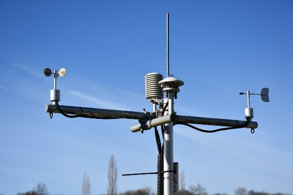
- Weather monitoring and observation. Siting, instruments and quality assurance for project weather stations.
- Site-specific forecasts for field operations. Site forecasts and sub-seasonal to seasonal outlooks, built from sources such as ECCC deterministic and ensemble forecasts and AI-based weather forecast models, for planning and managing weather risk.
- Transcribing historical records. Digitizing paper and archived weather records so older events can be analyzed.
What you receive
- Quality-controlled, gap-filled station series, with a log of every check and change.
- A site climate baseline: normals, extremes, trends and their uncertainty.
- Gridded or site datasets in CSV or NetCDF, with metadata.
- Event reconstructions: maps, time series and a plain-language summary.
Data we work with
We work with the records that fit the site and the question, such as ECCC station data (including adjusted and homogenized series), Water Survey of Canada hydrometric data, ERA5 and ERA5-Land reanalysis, the Canadian Precipitation Analysis (CaPA) and Canadian Surface Reanalysis (CaSR), satellite precipitation such as IMERG, ECCC deterministic and ensemble weather forecasts, and AI-based weather forecast models.
Questions we help answer
- Was this storm, wind event or cold snap unusual for this location, and how rare was it?
- What were the weather conditions at a site with no weather station?
- Is the station record good enough to design or model with, and where are its gaps?
- How have temperature and precipitation changed at this site since records began?
- What weather should field crews plan for over the coming days, weeks or season?
The experience behind it
- More than 30 years of station records for multiple sites in Lesotho checked, infilled with a stochastic weather generator and used to downscale projections for the Metolong Dam (GIZ, with the Climate Risk Institute)
- Gridded climate data for Saskatchewan’s Water Security Agency
- Bias-corrected 3-hourly 0.125° meteorological forcing for North America (1979 to 2016) and high-resolution forcing for the Mackenzie River Basin, published as open datasets
- Evaluation of IMERG satellite precipitation against ground observations over southern Canada (Journal of Hydrometeorology, 2017)
- Hourly temperature and precipitation from the ERA5 reanalysis, 1940 to 2024, for Ontario’s electric sector (EPRI)
- Uncertainty in ECCC ensemble weather forecasts for a Yukon streamflow forecasting system
From our principal’s research at the University of Saskatchewan’s Global Institute for Water Security, his consulting before Climalogik, and Climalogik projects. See Dr. Elvis Asong’s profile and our research.
Related: Climate projections · Design values for extremes · Expert opinions · All services
Discuss your project
Start with a 30-minute call with a climate scientist about your question, your data and your timeline.